


Treeline Terrains
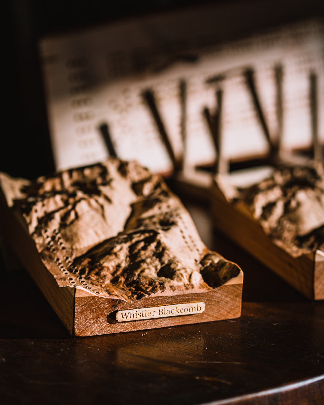
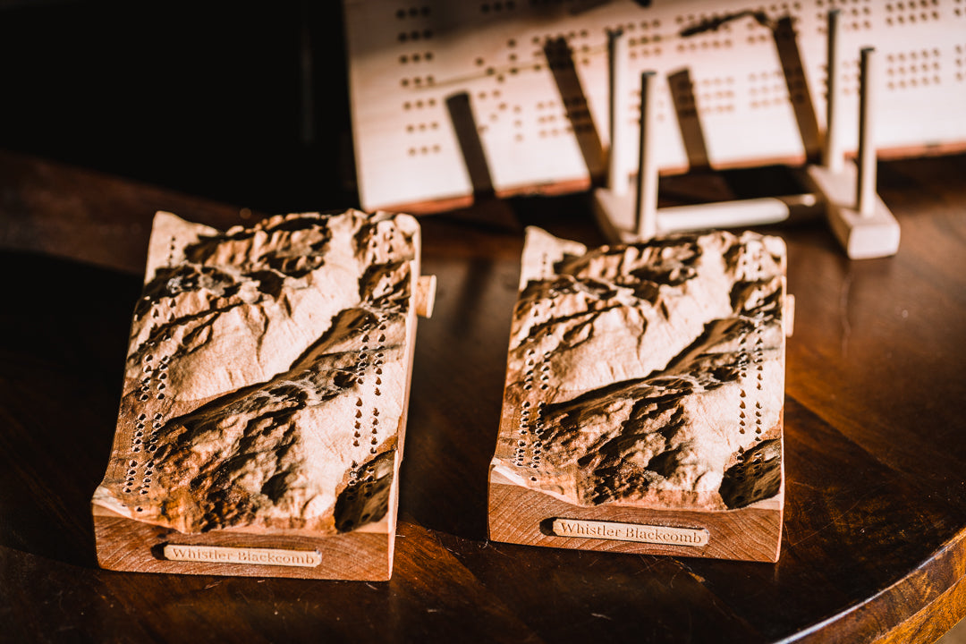
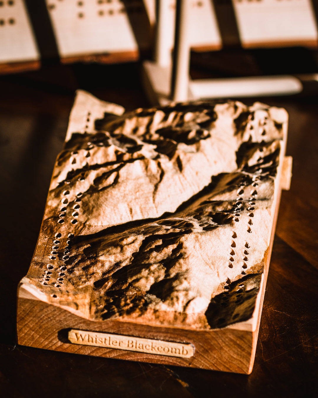
Treeline Terrains WB Cribbage Board
Pickup available at 2063 Lake Placid Rd #217, Whistler, BC V8E 0B6
Usually ready in 24 hours
Treeline Terrains WB Cribbage Board
2063 Lake Placid Rd #217, Whistler, BC V8E 0B6
Pickup available, usually ready in 24 hours
2063 Lake Placid Rd #217
217
Whistler BC V0N 1B2
Canada
Choose options
Proprietary mapping techniques allow Treeline Terrains to carve a map with the highest accuracy, using ultra high-resolution satellite data. Their software generates a 3D file of the landscape and writes a tool path containing millions of lines of positioning code, destined for CNC routers.
20cm x 12cm x 5cm